
Maps of Congress Poland and Wolyn/East and West Galicia
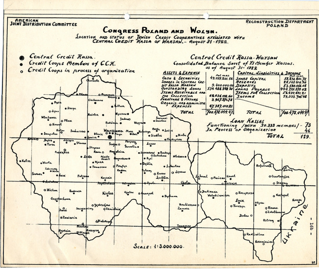
yarg335.2f005d001p002 (JPEG Image)Click image to zoom
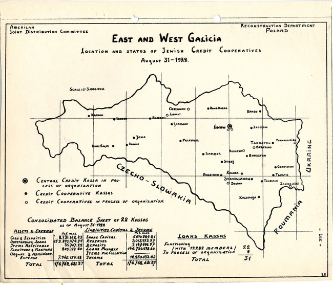
yarg335.2f005d001p003 (JPEG Image)Click image to zoom
Title:
Map of Congress Poland and Wolyn
Description:
Maps of the JDC Reconstruction Department. (First map) Map of Congress Poland and Wolyn. The subtitle reads: Location and Status of Jewish Credit Cooperatives Afflliated with Central Credit Kassa of Warsaw. (Second map) Map of East and West Galicia. The subtitle reads: Location and Status of Jewish Credit Cooperatives. The map includes Krakow, Rzeszow, Lwow, Brody, Przemysl, Tarnopol, Czortkow.
The JDC provided substantial assistance to Poland during the years following World War I, after the damages sustained by Poland during the World War. One of the JDC's accomplishments was the creation of a network of credit unions, or people's banks, which provided loans to individuals and organizations.
ID:
yarg335.2f005d001